Friday, June 28, 2013

Montréal

If Québec City is the Venice of Canadian cities--immediately, visually gorgeous and charming--then I think Montréal is its Rome. Big city, but so rich in variety and hidden gems, with more to notice and appreciate with each passing day.

I had the great fortune of spending my time in Montréal with Francophone CouchSurfing hosts, V and F, who truly made my visit. They took me out for my first poutine (the Québecois culinary, calorie-packed creation that starts with fries, gravy, and cheese curds, and goes from there)...


...took me for a long walk around the city that they clearly love so much (and I can understand why!)...


...gave me advice on what to do when exploring on my own (including checking out the hip Plateau neighborhood, with all its winding front staircases)...


...and alerted me to the bagel rivalry I hadn't known of between NYC and Montréal. I did try a fresh bagel from an impressive operation in Mile End (a neighborhood so like parts of Brooklyn that I kept forgetting where I was) and it was great, but I will reserve judgment on which city wins the contest for best bagel.


I even went to an improv show in French with V, which flew mostly over my head, but was a great experience nonetheless, especially as we went out afterward with some of her friends for more Montréal fun. Here is us showing ENTHUSIAM for this great city and life in general.


My last morning in town, a steady rain foiled my plans to climb to the lookout in Mont Royal city park, so instead I went to a yoga class. It turned out to be bilingual, with two teachers tag-teaming the instruction. SUCH a great class. I left the city floating on air and looking forward to returning some day. Hopefully sooner rather than later.

Tuesday, June 25, 2013

Bienvenue à Québec!

Lest I be accused (it wouldn't be the first time) of liking everything indiscriminately, I admit to not really admiring Labrador City. Or, to be more specific, that it's the site of the world's largest open-pit iron mine, which filled the winds that were whipping through the town (they call it a city, but...) with gross, gritty dust, filled a lake that I drove past in my attempt to leave with some kind of run-off that turned it a frightening pink, blood-like color, and made my crossing from Labrador into Québec a rude awakening of freight train tracks, enormous power lines, and criss-crossing access roads (all rough gravel). I drove through as quickly as possible, which was not quickly enough.

But then I was back on roads through breathtaking landscape in central Québec province. I'd been gently warned, farther east, that the Québecois aren't quite as friendly as people in other parts of the country. As if in directly reply, my first stop in the province was for gas (I still don't know where I was; the towns that my map said should be there weren't, and I was relieved to finally see an old-style gas pump and old-west-looking motel perched on a hillside), and pretty much the only two other people around both engaged me in warm conversation, the second one calling out "Bienvenue à Québec!" as I left. (I've since followed a protocol of conversing in French the best I can until/unless the person I'm talking with chooses to save his/her own ears and switch to English, and I haven't had a single negative experience. My only complaint is that people here drive like European maniacs, which is disconcerting after so many weeks among the very mellow drivers of the Maritimes.)

Driving south from Labrador, the Groulx Mountains were a sight to behold, along with the crater of the 5th largest meteor impact site on the planet (discovered when they dammed a river downstream and saw from an aerial perspective that this reservoir filled in a nearly perfect, enormous circle) and the dam itself.


Though crossing into Québec after days of Labrador felt like a big accomplishment, it was still another full day before I finally reached signs of civilization. (I got really excited when I saw some cows and realized that usually, I get excited about cows because it's a sign that I'm in a rural area, but this time it was a sign that I was in a populated area. Everything's relative!). When I finally hit the St. Lawrence seaway, I turned west and visited the Saguenay/St Lawrence Marine Park for some whale watching. Though, if you don't actually see any whales, shouldn't it be called "whale waiting"?


Then on to the spectacularly situated and very lovely town of Tadoussec, clearly a favorite of summer vacationers, where the Saquenay fjord (the most southerly fjord in North America) empties into the St. Lawrence.


After exploring a bit up the fjord, it was back to the coast, with a stop in Baie St. Paul, the place where Cirque du Soleil was founded (though they'd unfortunately chosen the height of tourist season to totally tear up their main street for repairs).


And then on to Québec City. WOW. I guess people told me to definitely stop in Québec City when I was planning this trip, but I don't think they really adequate stressed how ridiculously picturesque and romantic it is. I walked and walked and wandered and wandered, past the famed Frontenac...


...ate fresh strawberries from the old port market while sitting in La Place Royale, the core of the city as it was founded by Champlain more than 400 years ago...


...and just in general ogled this amazing place, which I would love to visit again. Maybe shortly before I die, when (?) cash and calories are of zero significance and I can just eat myself silly everywhere in the city? For now, it was enough to just appreciate its existence.


Saturday, June 22, 2013

The Big Land

Labrador is called The Big Land, which is a crazy understatement. It is vast, amazing, majestic.  No one whom I told of my plan to drive all the way across Labrador seemed to think it was a fantastic idea. At the most, I got raised eyebrows and warnings of days and days of driving on terrible roads that only recently exist and certainly aren't paved. I've decided that the problem is that I didn't talk to anyone who had actually made the drive. It's stunning.

I've taken to sleeping in my car. My plan for free lodging was to stick to dispersed camping on crown lands or Couchsurfing. But Couchsurfing hasn't really taken hold here and involves planning ahead, and right now I am feeling uncharacteristically averse to planning ahead. And declining the passenger seat to nearly horizontal and sleeping cozy in my sleeping bag in my car is so much easier than setting up a tent, plus more protected from cold and rain and bugs and bears. A shower is surprisingly easy to find when you ask around when passing through a town. The sun doesn't set until nearly 10 p.m., and the sky isn't totally dark until midnight. My sense of time is thoroughly warped and each day seems to last a week. There is waking on a side road adjacent to the only highway (much of it still rough gravel) across the province, nothing around but trees and bogs and sky, driving and driving, sometimes 250 miles between gas stations and settlements of any kind. Stopping for gas and maybe to restock my food and check my e-mail where possible and then driving again, into the amazing colors of the Labrador sunsets as the backdrop to more mountains, more forests, more enormous rivers and countless, unnamed lakes. Taking walks wherever possible. Otherwise just stopping to pee alongside the road, and then do some jumping jacks and stretching before resuming the drive. The gravel giving me a flat tire to change, careless monster-truck drivers giving me a seriously dinged windshield that will need to be patched later, on some other day in some other place. All of it feeling like a good and necessary part of the journey. Understanding the utter bliss and miracle of pavement after hundreds of miles of gravel. A black bear loping into the trees at the roadside, my car engulfed in mosquitoes within seconds of me slowing to a stop to try to get a picture of it. Driving again until the sun sets and I pull the car off the road to read for awhile by headlamp and then sleep again wherever I happen to have made it to when the light fades on another long day. I am in the travel zone. Will remember this time with great fondness and nostalgia, I can already tell. Such beauty and freedom.

Near Forteau:

The Pinware River:

North of Red Bay:

Close to St. Lewis:

The only three gas stops between the coast and Quebec (though the numbers are in kilometers):

Approaching Happy Valley-Goose Bay (Lake Melville):

Flat tire fixing. I'm not sure how long it was flat on the rough gravel; I only heard the problem once I turned onto the pavement for the first time all day, just outside of Happy Valley-Goose Bay. Being near town meant there were cars going by relatively frequently, and every single one of them stopped to make sure everything was okay and I didn't need more help. It wasn't until the task of changing the flat was actually set before me that I realized that my jack was buried under my voluminous stuff, which would take an hour to pack and unpack. So I did ask a passing car-full of Port Hope Simpson-bound kids if I could use their jack, and they immediately hopped out and insisted on doing the entire job for me, despite the insanely swarming mosquitoes (not pictured). One Newfie warned me to take a baseball bat to Labrador for the flies, and the Canada guidebook I have with me calls the insects in Labrador "murderous." Because of the coastal winds and unseasonably cool temperatures for the past few weeks, I hadn't really met that many bugs until I got to central Labrador...and I learned during this tire-changing episode that "flies" refers to all insects including mosquitoes. And I met a lot of them, as did these poor helpful souls.


Dust from the gravel roads collected everywhere--and it turns out the hatchback of the car is not at all sealed and a similar grit covers pretty much everything in the back of the car after so many miles.


West of Churchill Falls. There is apparently never a bad sunset out here.


Thursday, June 20, 2013

Labrador Coast

In the late 60's, the Canadian government offered a relocation plan to entice coastal--that is to say, pretty much ALL--Newfoundlanders and Labradorians to move from their tiny, remote, fishing enclaves into larger towns where it would be more economically feasible to provide federal services such as roads, medical attention, etc. For better or worse, everywhere I've been lately probably looks as it does (and very different from what it did more than 50 years ago) because of the relocations...and no where more so than coastal Labrador.


Even with all its residents better condensed into "larger" villages, this place feels pretty much empty, though. In a really great, if intimidating, way. This tourism ad says it perfectly, I think.


And the quiet and calm is complete. This is more of a place to be in, rather than to visit. If you're looking for things to do, there are ice bergs to photograph,


More lighthouses to drive to (always more lighthouses--this one at Point L'Amour, the tallest lighthouse in Atlantic Canada, I read somewhere),


A pair of museums at Red Bay commemorating the history of Basque whale hunters traveling to this town and using it as a base for becoming the biggest whale oil producers of 400 years ago (though the visit to Saddle Island, the third part of the site, wasn't possible due to them not wanting to disturb nesting eider ducks),


And turning off the pavement (which I wouldn't see again for hundreds of miles) toward Mary's Harbour, with its access to Battle Harbour, the centerpiece of coastal Labrador tourism and the former capital of the region due to its fishing commerce.


But it turns out that Battle Harbour is opening late this year, and they're raising the prices and requiring an overnight stay at a nice B&B, making it unrealistic to visit for riff-raff like me, anyway. So instead I drove on, past picturesque enclaves here and there...


...and especially to St. Lewis, where the apologetic Battle Harbour ferry employee who turned me away from that site told me I should go for iceberg viewing. A sign at the town entrance told me the name of the road leading to a walking trail for iceberg viewing, and in a town with three or four roads, it wasn't hard to find the one that led steeply uphill, past the town dump (now plagued by black bears) to the Deep Creek Trail, an amazing hike to an amazing sight.


And then, finally content with my iceberg viewing and fully saturated with the chilly, windy, rainy weather of the coastal regions I'd been exploring for the past several weeks, it was time to fill the gas tank to the brim and point the car westward, inland for the long, long, long, long, long drive across Labrador and into Quebec, not knowing what to expect but knowing that it would certainly be an adventure.


Tuesday, June 18, 2013

Go North!

I've been learning lots. Here's some of it:

Sometime around 100,000 years ago, some early homo sapiens turned their backs on the African landscapes from which they'd evolved and walked. Or ran. Whatever their motivations (and according speed of movement), they thought that what might be over the next mountain, and then the next, had a decent chance of offering better chances of individual and/or group survival. Some of these early human travelers wandered east, populating--over tens of thousands of ensuing years--the Middle East, Asia, the South Pacific, North America (via the Bering Strait), and South America. They made it all the way to Newfoundland & Labrador, the easternmost edge of the Americas, before being stopped by the Atlantic  Ocean and their lack of ships capable of tackling the cold, open ocean that faced them there.

Meanwhile, other early humans had wandered north from Africa rather than east, thriving in what is now Europe and Scandanavia. By 1000 A.D., the Norse people of Scandanavia (with the help of the new technology developed in the Iron Age) had developed ship-building techniques that allowed them to venture into the cold swells of the Atlantic to Iceland, and then Greenland, in search of timber and other profitable resources. (When they went marauding with the express purpose of plundering and pillaging--or "viking"--these fearsome Norse were referred to as "Vikings.") Eventually, they began exploring the coast of Labrador and discovered a spot that was, thanks to the nearby coast and distinctive islands acting as landmarks, relatively easy to find year after year. It was the very northern tip of what is now Newfoundland, and for about a decade they used it as base for exploring areas at least as far south as New Brunswick, where they collected wine grapes and butternut wood. When they first arrived, the area was unoccupied, but they must have seen signs of other peoples having inhabited the area before them. Whether they eventually had unfriendly encounters with those other people that encouraged them to decamp, or whether the withdrawal was purely due to the long voyage from Greenland not being economically beneficial, the Norse soon abandoned the site. Back home, they developed sagas that referred to this territory they'd briefly explored as Vinland and hinted at conflicts with other humans they'd encountered there.

What they could not have known is that the Norse settlement at what is now L'Anse Aux Meadows is the earliest known European settlement in the Americas, and the earliest documented figurative--and likely, at some point, literal--re-meeting of the human race 100,000 years after it first ventured forth from Africa. At this place, humans completed an encircling the planet, for better or worse.

Because of the cultural significance of this spot, L'Anse Aux Meadows is a UNESCO World Heritage Site, and the remains of the Norse settlement here, as well as the reconstructions of their dwellings created by Parks Canada just adjacent to the actual structures of the settlement, are icing on the cake.

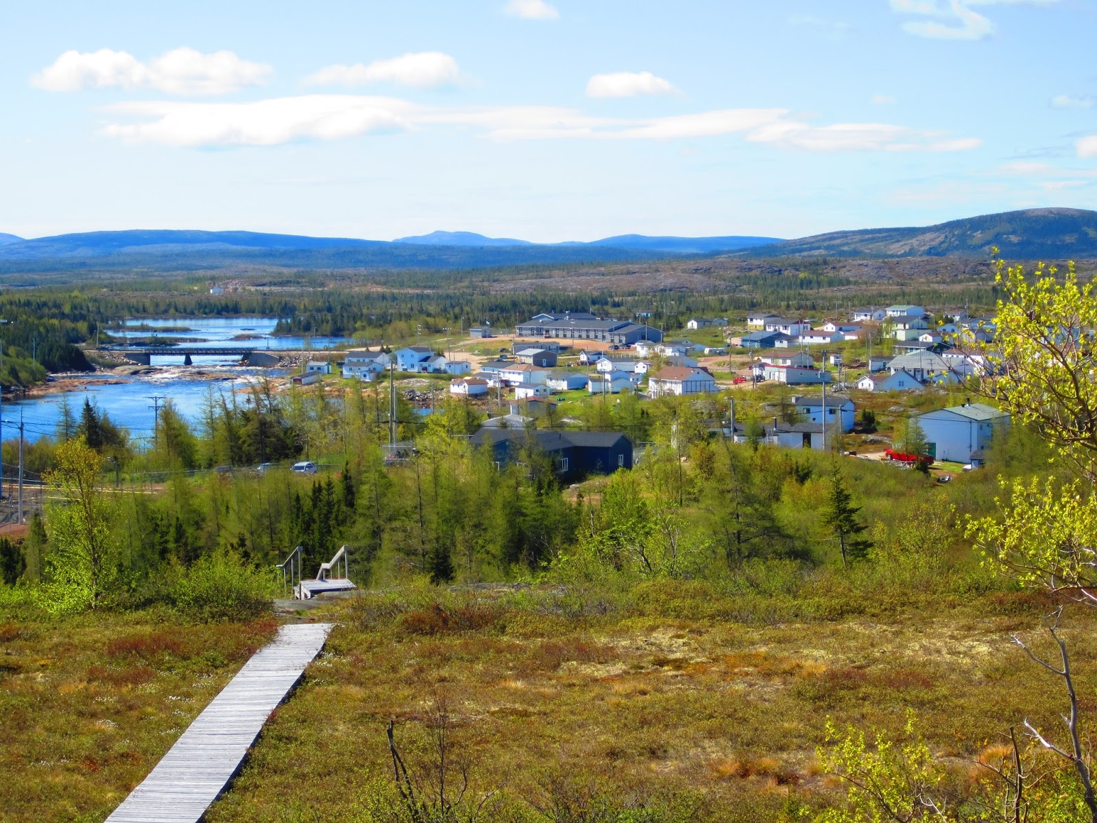
Compared with the journey humanity took to arrive at this place, my five-hour drive north from Gros Morne to reach it was pretty much nothing. It was still very exciting for me, though, as after wondering if I would get to see any icebergs at all after my failed attempt at Twillingate, I started seeing bergs about halfway up the northern peninsula. (Little did I yet know that icebergs would be the main feature of the watery landscape from that point on until I finally turned from the Labrador coast inland several days later. And that it was kind of laughable of me to ever have worried that I wouldn't see any and to have stopped to take a picture of this first, tiny one that I spotted.)


In addition to all its cultural significance, L'Anse Aux Meadows has the benefit of being a forlornly beautiful place with the feeling of being at the edge of nowhere. Though, honestly, much of Newfoundland and Labrador has that feeling. I love it.


This sculpture was created to signify/commemorate the meeting of east and west here, the completion of human migration around the globe.


And most likely, very literally, Leif Erikson (son of the great Norse explorer Erik the Red--and not too shabby an explorer himself) slept in a long-ago shelter whose foundation impressions can still be seen right here.


Though clearly not the real thing, the Parks Canada reconstructions of what the structures built here by the Norse probably looked like were fun to see.


And check out this anchor, which is probably what anchors looked like before people figured out how to produce iron in quantities that allowed them to be made of metal!:


I'm usually not a museum person, and don't get particularly captivated by sites and stories revolving around human history. But as you can tell, L'Anse Aux Meadows really made a big impression on me. As did northern Newfoundland in general. There were the moose, which finally made an appearance en masse after much hype about their local nuisance--though too late for my mom to enjoy them scattered at the roadside at dusk.


And there were the charming gardens appearing seemingly at random on the roadside.


I learned that people here, almost exclusively fishermen by trade, would come a bit inland, away from the cold northern winds that whip the coast year-round, to plant gardens where they could be more productive. Now that a highway (truly a single road up the peninsula, with the rest of it wild forest and bogs and mountains--take a look at a map) runs through, it provides convenient access for the people, still living on the coast, to take a jaunt inland and set up a garden, which they are apparently free to do wherever they please. (It also struck me how consistently I saw people walking or jogging on highways like this--even the part of the Trans-Canada Highway that runs through Newfoundland. I finally realized that they walk and run on the highway because there is nowhere else to do it, no other roads, just trees and water and moose and hills, as far as the eye can see.)

Another thing I learned yet again in northern Newfoundland, is how resoundingly NICE the people here are. They are ruggedly self-sufficient, asking for nothing from anyone, expecting nothing but hard work. And yet they are so genuinely NICE. Who could not love the Newfie accent, sometimes nearly incomprehensible to us outsiders, with every sentence ended with a sympathetic, "right?" (Encouraging you to nod even if you have no idea what was just said.) Or the way everyone--young, old, male, female--called me "my darlin'"? If there are awarded global prizes for the flat-out nicest people on the planet, I would like to nominate the natives of the Canadian province of Newfoundland & Labrador. For, as I was about to learn, the niceness is still there across the Straits of Belle Isle, in Labrador. I hopped a ferry...


...and sailed the short but choppy ride (past increasingly large icebergs)...


...in they grey, cold rain back to the mainland, for the next chapter of the adventure.

Monday, June 17, 2013

Gros Morne

When I was in middle school, I read this futuristic short story with an environmentalist bent, which had something to do with what would happen if global warming caused the entire midwestern U.S. to become a sea and Denver was then a coastal city, with the Rockies rising up behind its shoreline. I have no idea what the story was called, but it made a really big impression on me.

After Twillingate, I continued back to the western side of Newfoundland and then crossed up into the northern peninsula, bound for Gros Morne National Park. Which is as stunning as promised. And looks a lot like what Colorado might look like if, as in that long-ago story, it were a place where the mountains meet the sea.


There is also some absolutely amazing geology here. First, there's the Tablelands--flat-topped mountains composed of rock from the earth's mantle. There aren't many places on earth where mantle rock has been pushed to the surface, and certainly none where it is more accessible and easy to reach than it is in Gros Morne. It (again) reminded me of Colorado, when you get up above treeline and not much can grow. But in this case, things can't grow on this rock because its composition is so unusual and alien at Earth's surface. The mountains directly across the valley from these were green as Ireland...


After gawking at Tablelands, I hiked to the water on the steep but beautiful Green Gardens Trail.


And then the next day hiked to Bakers Brook Falls, through bog and pines.


Later that afternoon, I went to a ranger-led walk at Green Point, only to find four Parks Canada rangers being led by a fifth in an educational session that would help them lead these walks in a few weeks, when the tourist season actually gets started. (Theme of my trip so far: I am several weeks ahead of the typical tourist season, which is basically just July and August. This is great in that nothing is very crowded and I never have to make reservations for anything. The downside is that it's definitely on the chilly side, and a lot of things just aren't open yet.) Happily, they invited me to listen in, so I got a full lesson on the geology of Green Point, which is also totally incredible. Here, the rock was folded up during a continental plate collision and is now folded past 90 degrees from where it was deposited. There is an uninterrupted exposure here that includes the Cambrian and Ordovician (apparently very rare to find uninterrupted), and an even more rare layer where a shallow-water reef avalanched into deep-water sea, forming a conglomerate that has fossils from both ecosystems, allowing geologists and archaeologists an amazing opportunity to cross-reference their dating of many fossils species of that era. And on top of all of this, the rock layers here just looked really beautiful. Fun to dork out on a geology class all afternoon.


Even more beautiful: sunset at Lobster Point Cove.


I left Gros Morne reluctantly, with half a dozen other hikes and activities still on my list. This is a place to return to, if ever there was one....